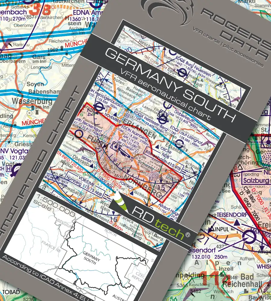
Rogers Data Germany South VFR ICAO Chart 500k
€34,90 inc. VAT / Jahr
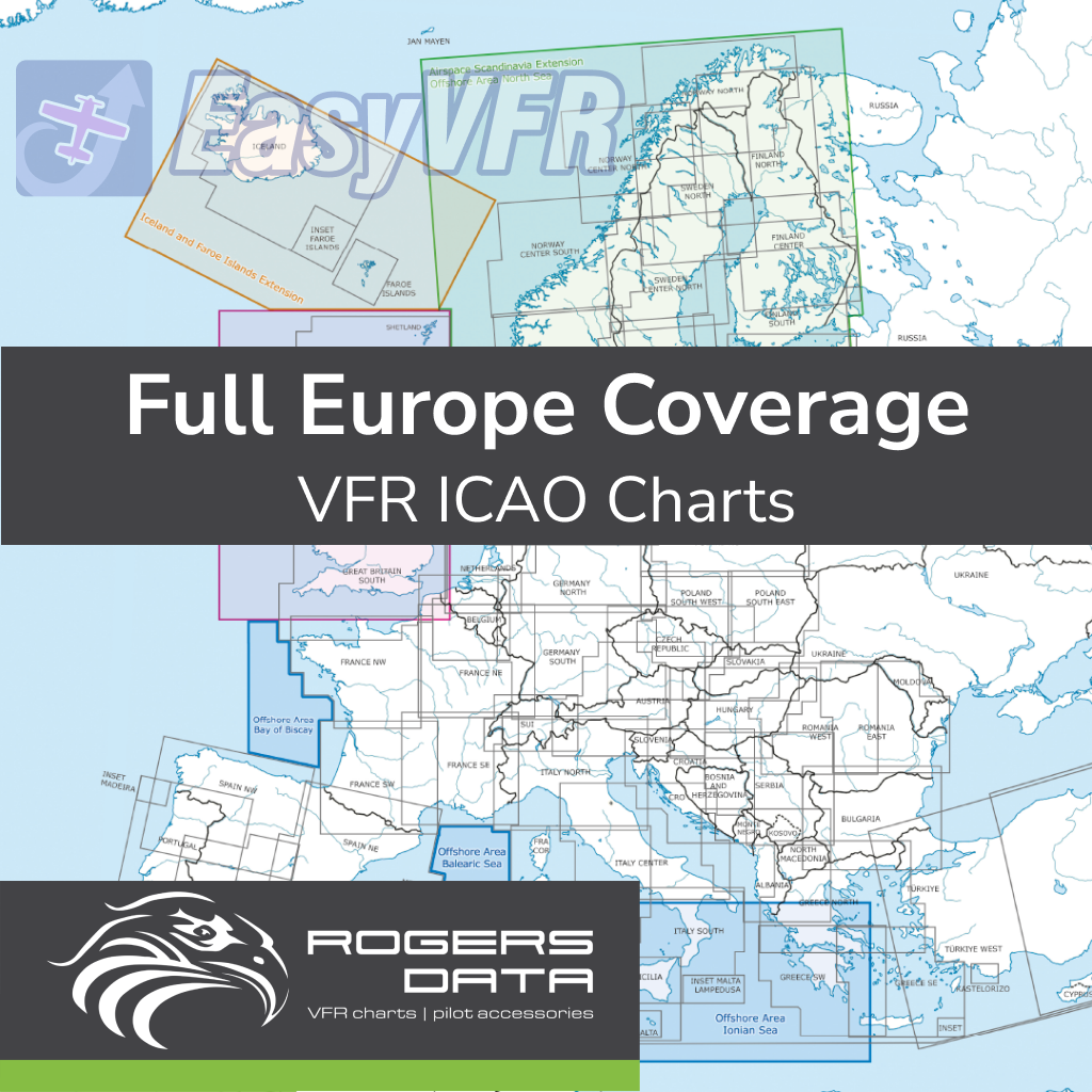
Navigate Germany with confidence using Rogers Data VFR ICAO Charts (1:500,000). These highly detailed charts offer a dynamic 3D topographic view, essential airspace information, reporting points, danger zones, and obstacles for enhanced low-level safety. Compliant with ICAO Annex 4 and EU regulations, just two charts cover all of Germany.
- According to ICAO Annex 4; EU-Commission Regulations; AIP
- Updated during the validity of the subscription
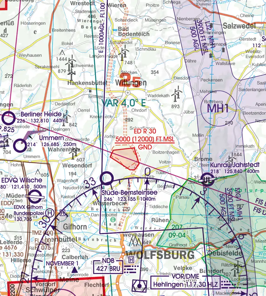
- Clear representation of the ATS airspace structure
- Reporting points, border crossing points
- Danger- and restricted areas
- Aerial sporting and recreational activities
- Areas with sensitive fauna
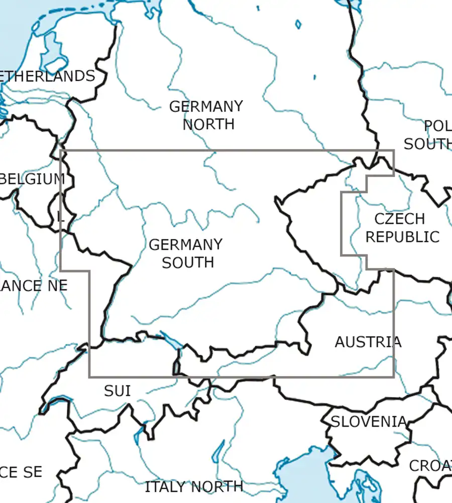
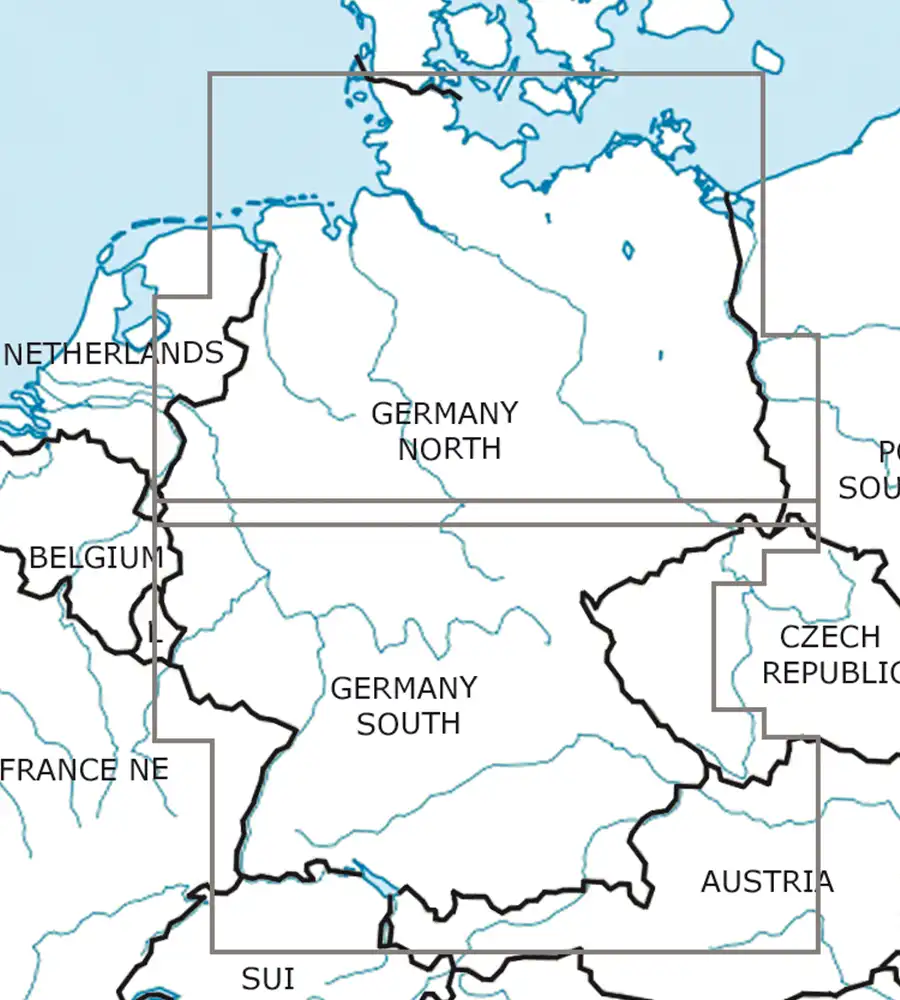
Only two charts needed for Germany (Germany North and Germany South)!
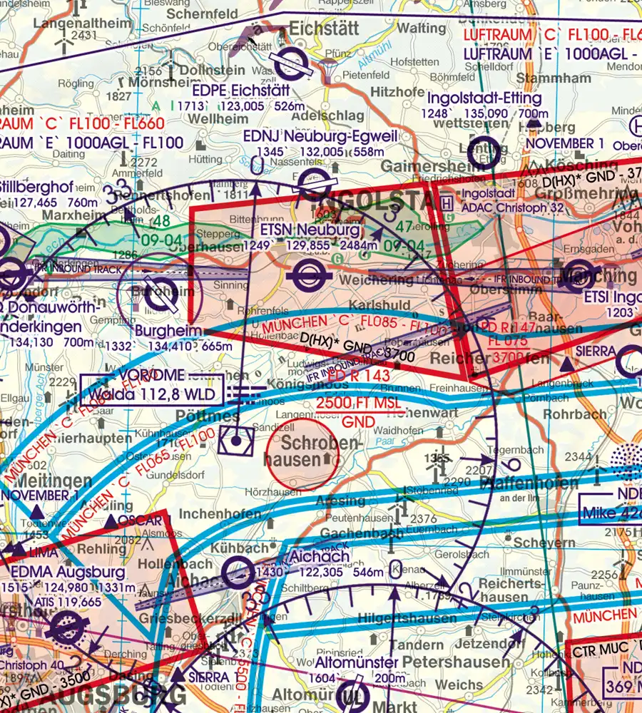
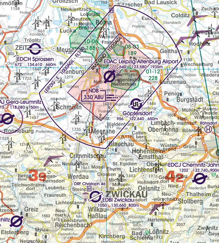
Rogers Data VFR aeronautical– ICAO charts have a very detailed representation of ATS airspace structures. They use a high-quality topographic map with shading and relief. This creates a dynamic 3D impression.
The charts include TMZ transponder mandatory zones, RMZ radio mandatory zones, airports, aerodromes and heliports with additional information, compulsory reporting points, reporting points on request, significant points (border crossing), Radio Navigation Aids with name, frequency and morse code.
Danger-, restricted- and prohibited areas, obstacles or group of obstacles and aerial sporting and recreational activities and areas with sensitive fauna. Furthermore, high-voltage powerlines are shown to increase situational awareness and flight safety in low-level operations. An isogonic line model with magnetic variation is included to support accurate navigation and heading corrections.
All Rogers Data VFR aeronautical charts are based on the latest aeronautical information from AIP and their supplements of CAA. They are based on the relevant regulations of ICAO Annex 4 and EU-Regulations.
Germany South VFR ICAO Aeronautical Chart
Current edition. Updated during the validity of the subscription.
Special features for this region:
- TMZ transponder mandatory zones
- RMZ radio mandatory zones
- Aerial sporting and recreational activities
- Areas with sensitive fauna
- Heliports with name of Operator
- Significant points (border crossing points)
All Rogers Data VFR charts are designed to the following criteria:
- Germany South aeronautical chart on a scale of 1:500.000
- According to ICAO Annex 4; EU Commission Regulation; AIP
- Clear representation of the ATS airspace structure
- Detailed highly sophisticated terrain map with shading and relief
- Airports, aerodromes and heliports with additional information
- Radio Navigation Aids with name, frequency and morse code
- Compulsory reporting points, reporting points on request, significant points (border crossing)
- Danger- and restricted areas
- Obstacles or group of obstacles
- Minimum Grid Area Altitude
- Isogonic line model with magnetic variation
Zusätzliche Informationen
| Delivery Methode | Download from website to EFIS USB stick, Dropbox data delivery, Download within EasyVFR 4 app, Export from EasyVFR 4 app to EFIS USB stick |
|---|---|
| Compatibility | Advanced Flight Systems AFS-5/6XXX series, Dynon Certified, EasyVFR 4, Dynon SkyView Classic and HDX |
| Country and Region Coverage | Germany |
| Necessary Plan | EasyVFR Essential, Dynon Data only, EasyVFR Live, EasyVFR Pro, Frequent Flyer Membership |