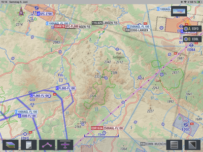
When planning a route through central Germany it is troublesome to have the map filter out certain airports at higher zoomlevels. Only some UL fields and Gliderfields are still displayed, because they seem to have especially long (gras) runways.
To see other airports it is necessary to zoom in, which of course looses the overview. So it is a constant zooming. Additionally the processor will recalculate airspace and terrain, so zooming takes some time until all info is displayed again.
I would like to see far more airports as my pictured map is not yet cluttered. I do not want to hide gras runways ! I just want to see the shorter asphalt ones as well.
Runway length does not seem to be a good definition for the decision to display or not. I’d rather have some overlapping icons than none at all.
The upcoming version will no longer declutter airfields at all (up to a specific camera altitude that is), but simply render all airfield symbols smaller and smaller with increased camera altitude to avoid cluttering. This has some impact on performance because now instead of a few tens now it can be a a thousand airfield labels that need to get decluttered, but by making that not too smart performance is not suffering noticable (at least not on ipad mini 5). Lets see what experience with this new feature will be when upcoming beta is released.

