
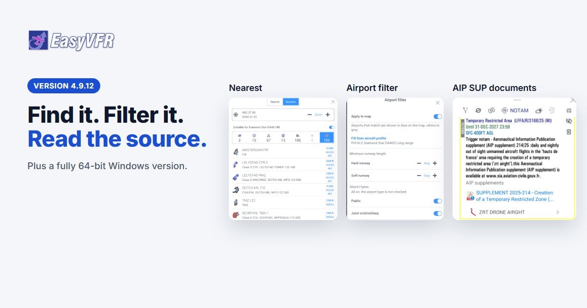
Nearest and a new Search, an airport filter, links to AIP Supplement documents, and EasyVFR 4 for Windows in 64-bit
Hello fellow aviator,
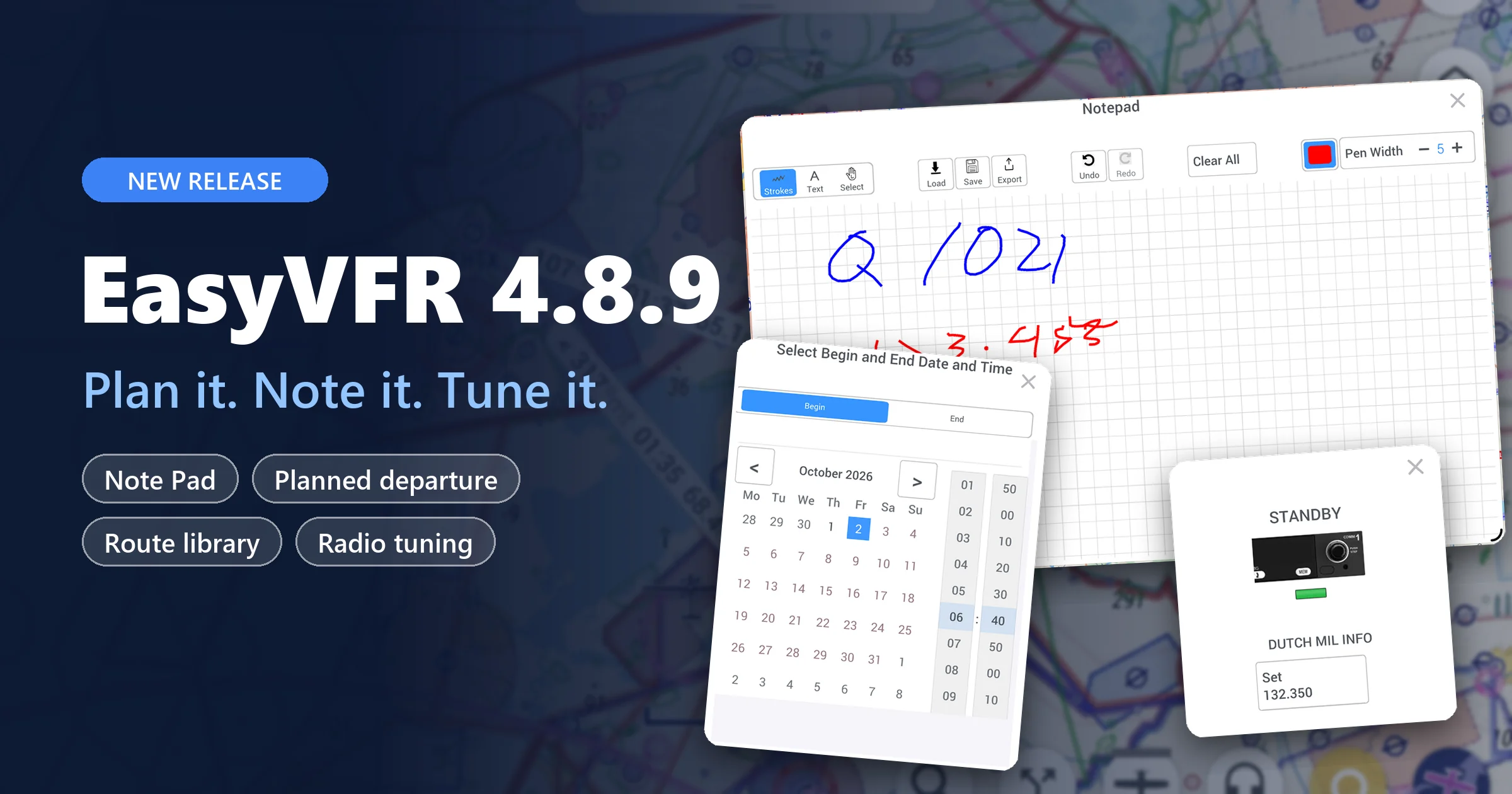
In our 4.8.9 post we told you what we were working on: 64-bit Windows, a Nearest option, and links to AIP SUP documents. EasyVFR 4.9.12 brings all three. Find what's around you, keep only the airfields that suit your aircraft, and read the official publication behind a temporary airspace without leaving the map.
Highlights at a glance
- AIP Supplement documents: open the official document behind a temporary airspace or NOTAM, right from the map
- Airspaces from NOTAMs: a NOTAM that creates an airspace now links to it, drawn on the map
- Nearest: airfields, airspaces and reporting points around you, sorted by your track
- New Search: category tabs, recent searches and the route actions in one place
- Airport filter: runway length, airport type, fuel and services, on the map and in your lists
- Windows: EasyVFR 4 is now fully 64-bit
- Android on the latest toolchain, and 15 fixes
Thank you to everyone who tested the 4.9 betas since September. Many of the details below came straight from your feedback.
On this page:
- Open the AIP Supplement document behind the airspace
- Nearest: what's around you, by your track
- A new Search
- Airport filter: only the fields that suit you
- EasyVFR 4 for Windows, now 64-bit
- More enhancements and fixes
- How to update
Open the AIP Supplement document behind the airspace
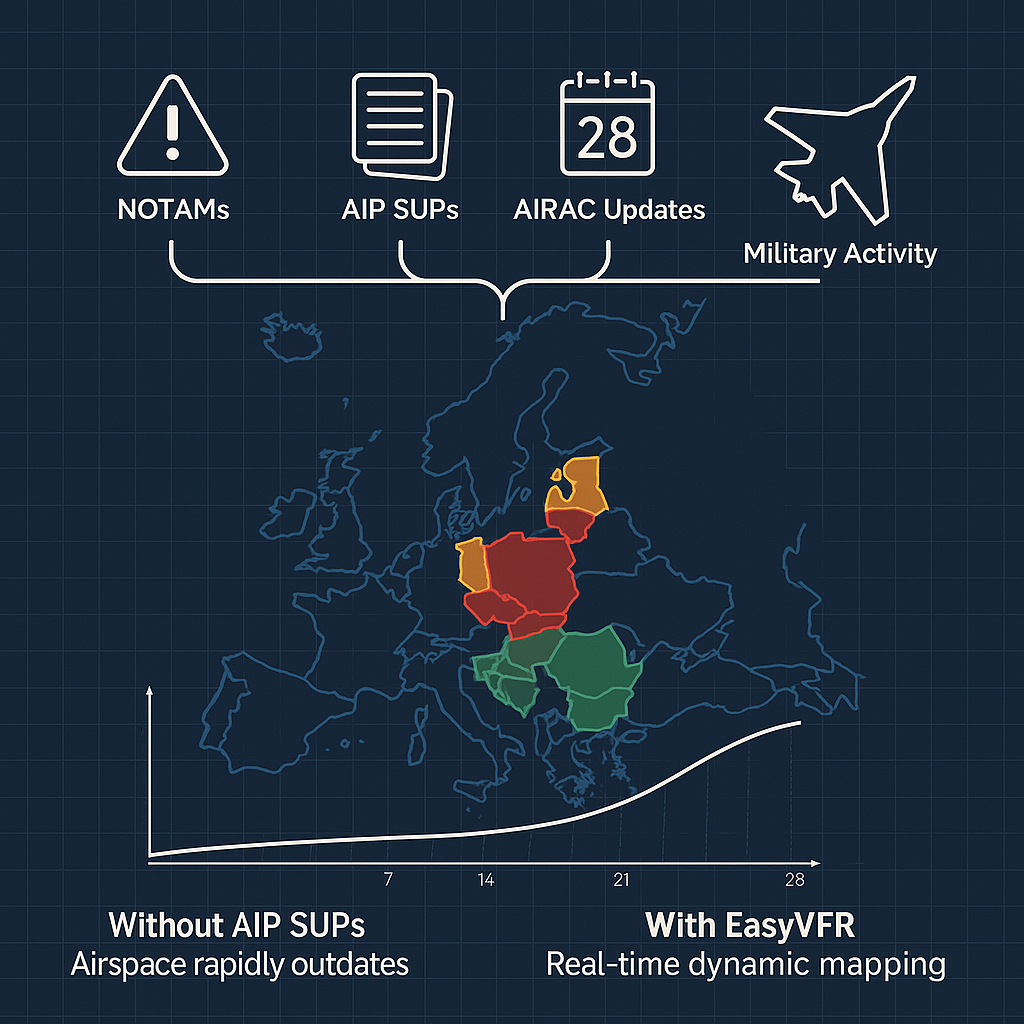
Temporary airspaces from AIP Supplements have always been on your EasyVFR 4 map: our AeroData team tracks AIP Supplements in 42 European countries, and in 2025 alone they caused 1,861 airspace changes. The map shows the area. The document holds the rest: how and when it's activated, who to contact, and what is expected of you.
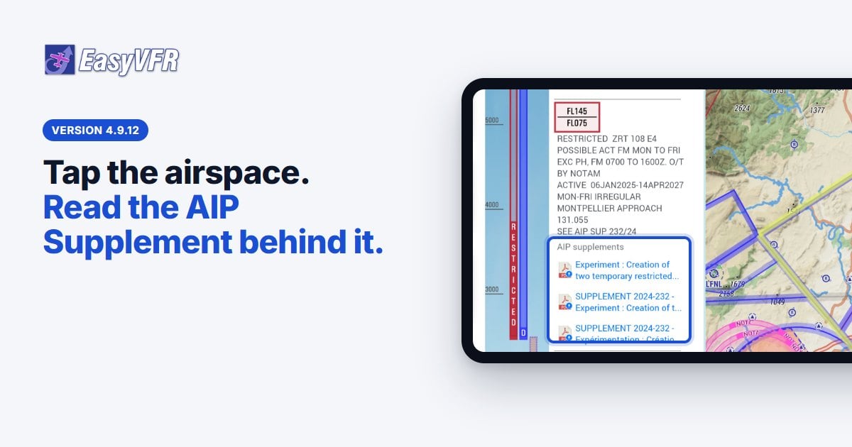
New in 4.9.12: the document itself is one step away. Select the airspace on the map, open the Airspace or NOTAM tab, and select the PDF under AIP supplements. The original document opens inside EasyVFR 4. Select Back to EasyVFR 4 to return to your map, or Share… to send it on.
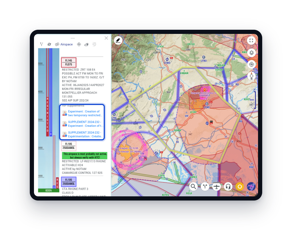
Airspaces created by NOTAMs
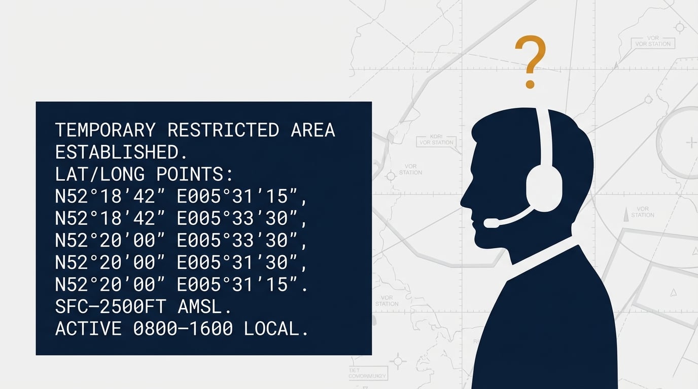
Ever read a NOTAM about a temporary restricted area and wondered where it actually is? For a long time our AeroData team has scanned new NOTAMs every day for airspaces they create, and added those to our database. Now you see the connection: the NOTAM card links to the AIP Supplement document and to the airspace itself.
Here NOTAM LFFA/R/3166/25 announces drone flights beyond visual line of sight in the Hauts-de-France. The text doesn't show the shape. EasyVFR 4 draws the ZRT AIRGHT corridor from Berck past Abbeville to Amiens, and one selection jumps to it.
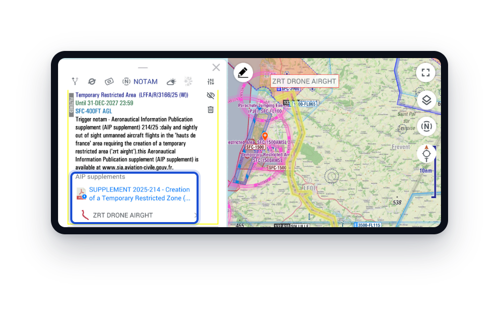
The Info Sheet is a summary; the AIP Supplement is the legally binding publication. Before a flight near a temporary area, read it. With 4.9.12 it's one step away.
Nearest: what's around you, by your track
Select the search button in the Bottom Button Bar and switch to Nearest at the top of the window. It lists everything around your GPS position, up to the range you set with + and − (5 to 250 nm, 50 nm by default). Without a GPS fix it works around the map center. Where EasyVFR 4 knows your track, it uses it for directions and order.
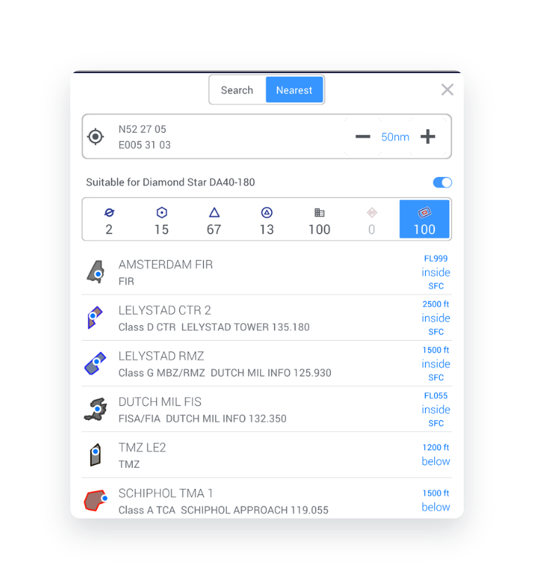
- Airfields show their map symbol, an arrow and distance relative to your track (straight up is dead ahead), and the runway turned to your track: flying 090 to a field with runway 18/36, the bar lies across your path. The row also shows elevation, the longest runway (and whether it's soft), PPR, fuel types and the first frequency.
- Airspaces show their real outline in map colors, with a blue dot where you are inside it. A small altitude stack shows whether you are above, inside or below, using GPS altitude and the QNH from a nearby METAR where available. Above about 30 kt, a row says in 12.3 nm when your track enters it, with an orange chevron at the entry point. Airspaces you're in come first, then the ones your track will enter, nearest first.
- VFR reporting points show whether they're compulsory, how they're used and at what altitude (Inbound · 1500 ft), and any restriction such as Helicopters only.
- Navaids, IFR waypoints, cities and user waypoints are sorted by distance, with the same arrow and distance.
A new Search
Search shares the window and the category tabs with Nearest: airfields, navaids, IFR waypoints, VFR reporting points, cities, user waypoints and airspaces, each with its number of results.
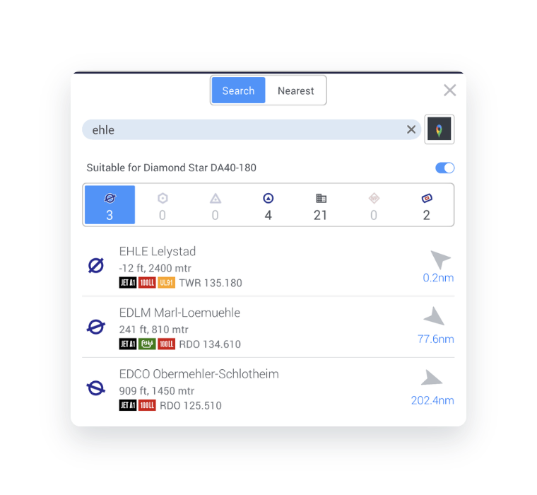
- Results sort into the tabs as you type, and your recent searches show as soon as you open the window
- The pin button next to the text field switches to Google places search
- Select a result for its actions, in the same order as on the map: Direct-To, Depart, Insert, Append, Remove, Alt 1, Alt 2, Info and Show on the map
Airport filter: only the fields that suit you
Many of you asked for an easy way to see which airports you can actually use. Open Map Layers → Airport filter, right below Map Timeframe, and set what you need:
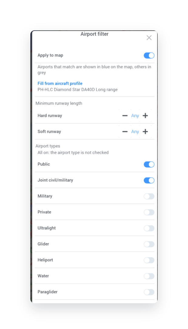
- Minimum runway length, separately for hard and soft runways
- Airport types: public, joint civil and military, military, private, ultralight, glider, heliport, water, paraglider and paramotor
- Fuel (any of): an airport passes when it has any fuel you tick, for example UL91 or AVGAS 100LL
- Services, such as customs
Fill from aircraft profile takes the requirements of your selected aircraft, so you don't enter them twice. With Apply to map on, airports that pass are drawn in blue on the moving map and the others fade to grey; the symbols keep their shape, so you can still tell hard, soft and military fields apart.
In Search and Nearest, Apply airport filter shows only the airfields that pass (it replaces Suitable for <your aircraft>). Nearest then searches your whole range, so a suitable field a bit further away is no longer missed.
EasyVFR 4 for Windows, now 64-bit
EasyVFR 4 for Windows has moved from 32-bit to 64-bit and uses the latest ANGLE graphics libraries. It sounds technical, but it's an important milestone for us: the 32-bit version held back several improvements we wanted to make across the app. With every platform now on a modern 64-bit foundation, that restriction is gone.
On Android, EasyVFR 4 is now built with the latest native toolchain. It meets the Android 16 requirements and is being tested against Android 17. That work already fixed several Android-specific bugs, and gives us a much better base for the next versions.
More enhancements and fixes
Map and Info Sheet
- Labels are decluttered at lower zoom levels, so the map stays readable
- Airspace labels show at better zoom levels
- The close button of the Info Sheet moved to the top right, so a double tap no longer opens the notes underneath
- The AIP Supplement airspaces list no longer shows internal airspace identifiers
- UK CAA map theme: disused airfields look better
- On an iPad with a Bluetooth mouse, the mouse wheel zooms the map
Traffic and radio
- Better squawk suggestions on the Radio Card
- Other traffic shows speeds in your chosen unit, and the + or − of the altitude difference is as large as its digits
- Updated FLARM decoder and translations
Fixes
- Fixed: user waypoints could be lost after a restart. They're now saved after every change, and files damaged by older versions are repaired once.
- Fixed: route planning could ignore the published altitude of a VFR reporting point, or plan a leg to or from it at 0 ft
- Fixed: EasyVFR 4 could freeze while searching map data, after an earlier exit had not saved a data file completely
- Fixed: a gap in the terrain of the Vertical Profile where the track crossed a country border
- Fixed: after closing a window, heliports could be drawn smaller and wind turbines could disappear from the map
- Fixed: searching for WIN did not find the WIN navaid
- Fixed: a flight plan name with a dot in it was cut short
- Fixed: a unit change in the aircraft profile (Simple and Easy mode) was lost after a restart
- Fixed on iOS: activating SafeSky Premium from the SafeSky app, broken in 4.8.9
- Fixed on iOS and iPadOS: a freeze in number-only fields
- Fixed on Android: after swiping EasyVFR 4 away, it could hang on a white startup screen until you forced it to stop
- Fixed: two crashes, one during background downloads
- Windows keeps a crash report if EasyVFR 4 ever crashes; mention it when you report one
See the release notes in our forum for the full list.
How to update
Update EasyVFR 4 from your device's app store, or download it for Windows from our download page.
Which feature will you try first? Tell us in the forum or write to [email protected]. We read every message.
Fly safe, fly prepared,
The EasyVFR Team
More from our blog
- Now in EasyVFR: open the AIP Supplement documents from the map
Three French examples, each next to its official publication. - The airspace that doesn’t exist on your chart
Why so much restricted airspace is invisible to most pilots. - EasyVFR 4.8.9: Plan it, note it, tune it
The previous release: Note Pad, planned departure and radio tuning. - Connect your AI assistant to EasyVFR and NOTAMbriefing.com
Ask ChatGPT or Claude for a NOTAM and airspace briefing with your EasyVFR account.




0 Comments