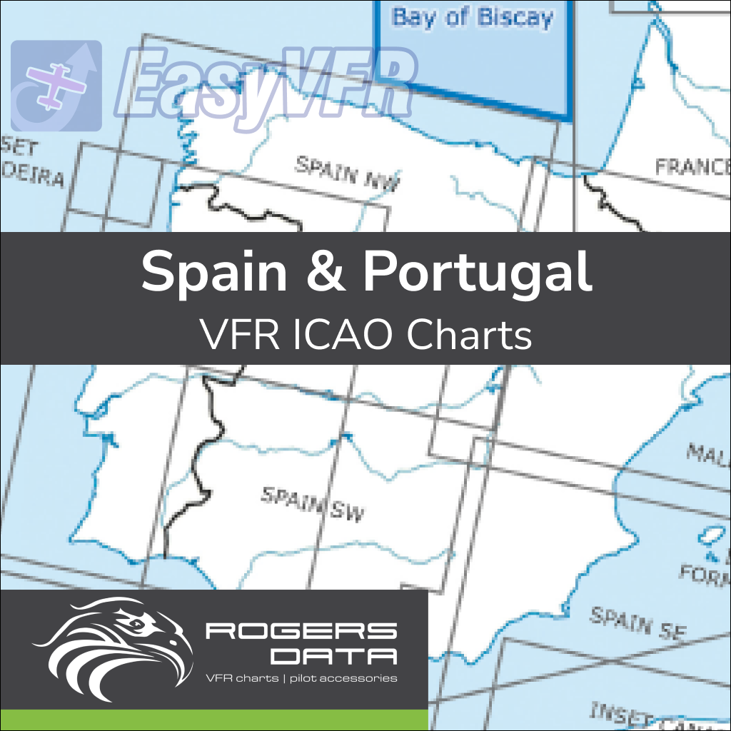
Rogers Data Spain & Portugal VFR ICAO Chart 500k
€89,90 inc. VAT / year
Navigate Spain and Portugal, including the Canary Islands and Madeira, with the Rogers Data VFR ICAO Chart (1:500,000). This chart offers a clear depiction of ATS airspace, reporting and border crossing points, danger and restricted areas, and highlights aerial sporting activities and sensitive fauna areas. Compliant with ICAO Annex 4 and EU regulations.
- According to ICAO Annex 4; EU-Commission Regulations; AIP
- Updated during the validity of the subscription
- Clear depiction of ATS airspace structure
- Reporting points and border crossing points
- Danger and restricted areas
- Aerial sporting and recreational activities
- Areas with sensitive fauna
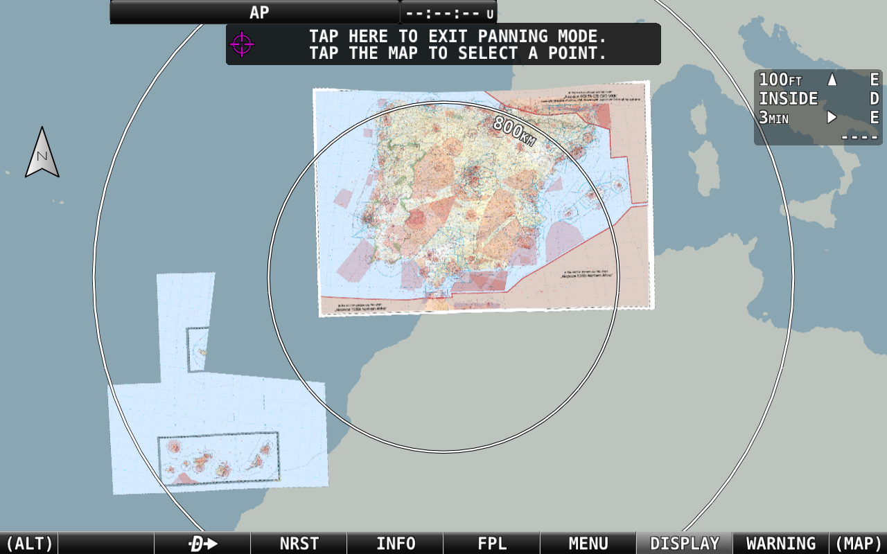
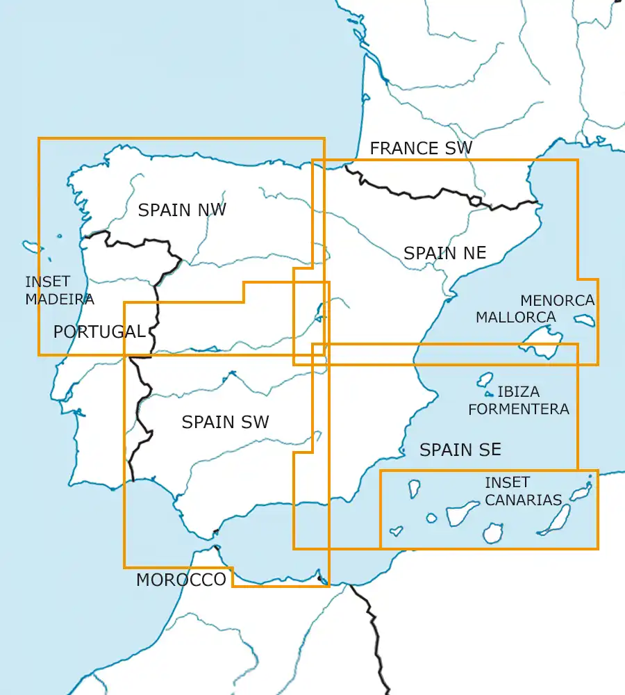
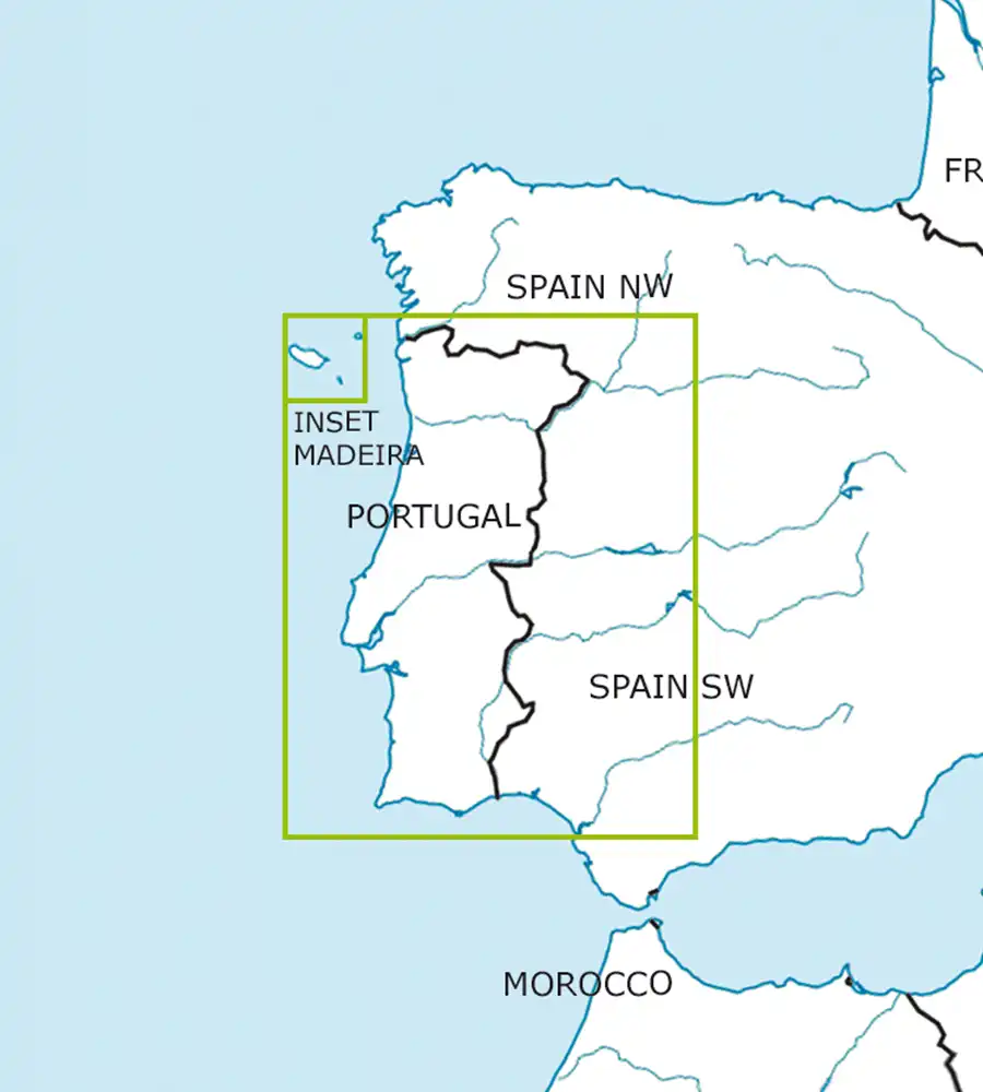
Four charts combined in a single large chart for easy cross region navigation.
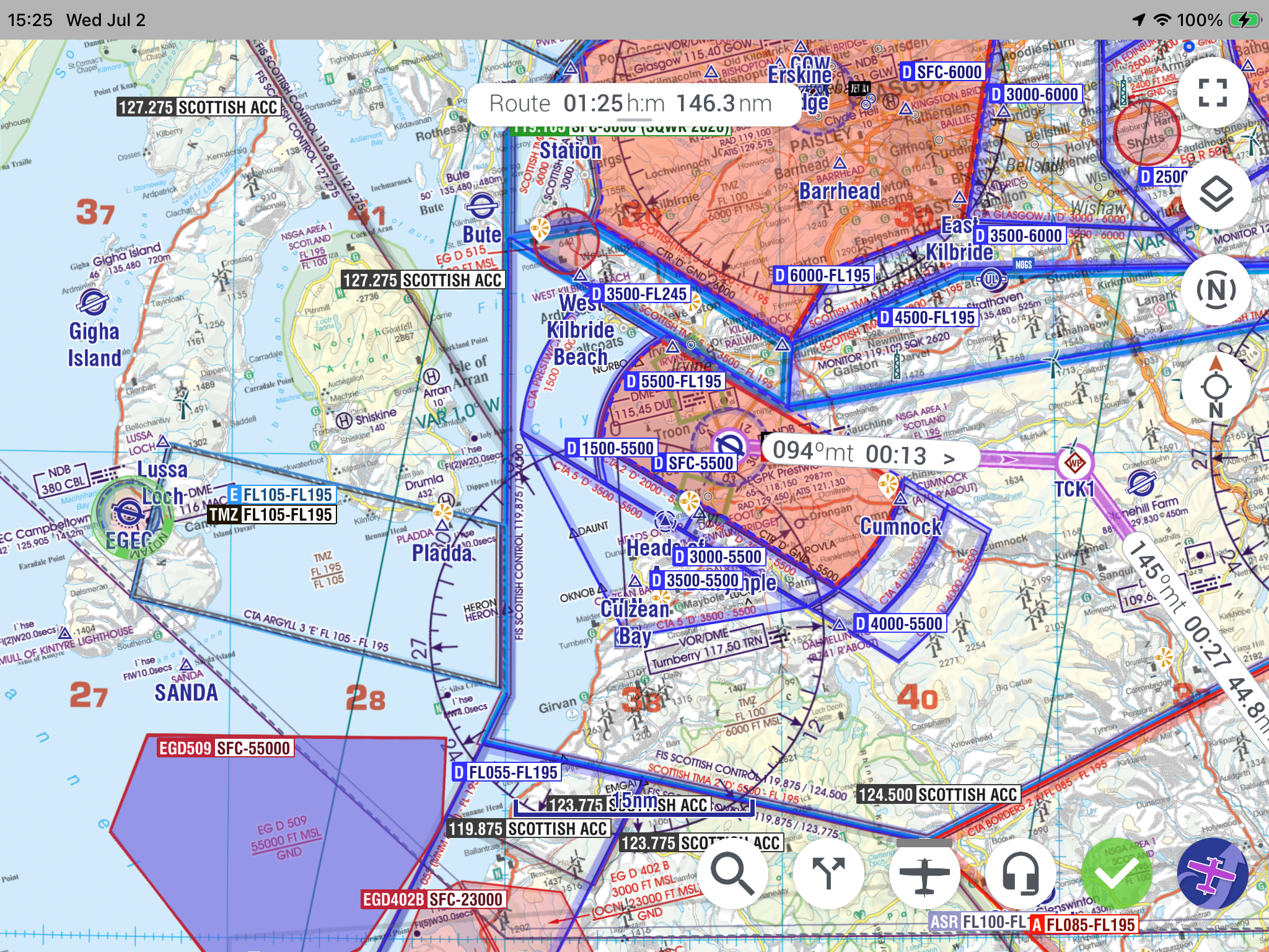
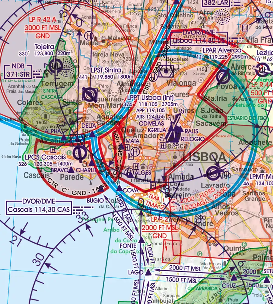
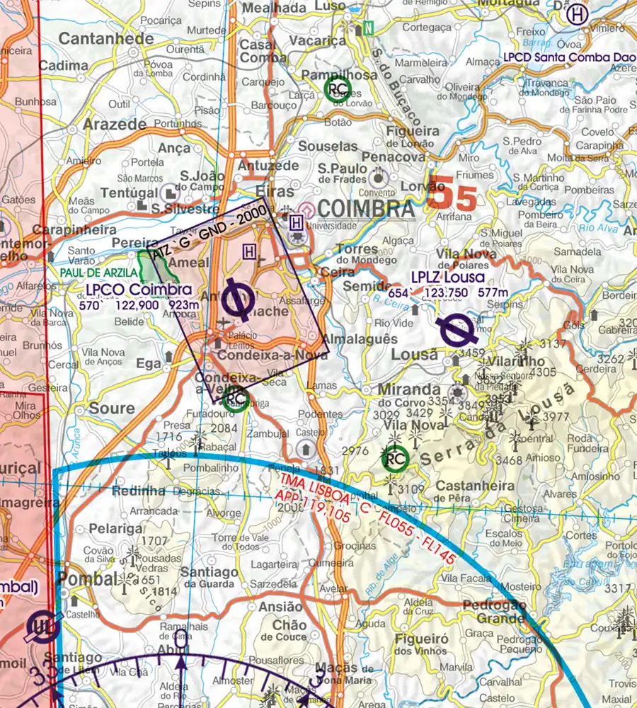
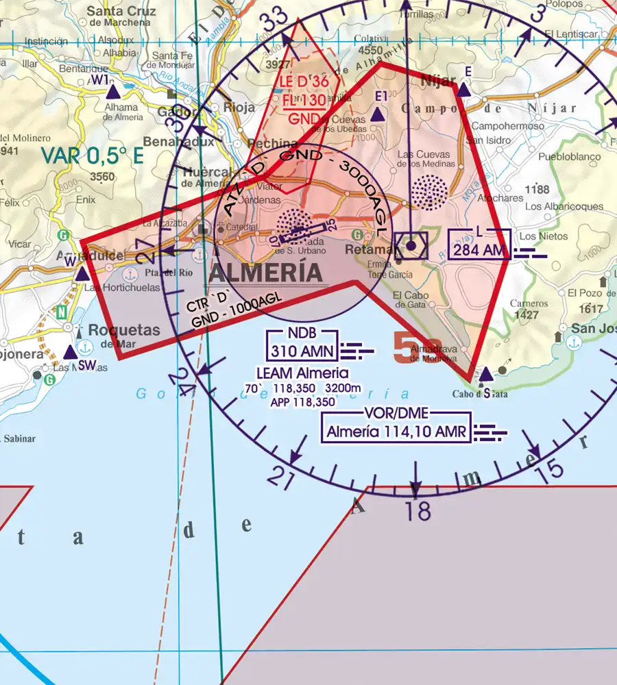
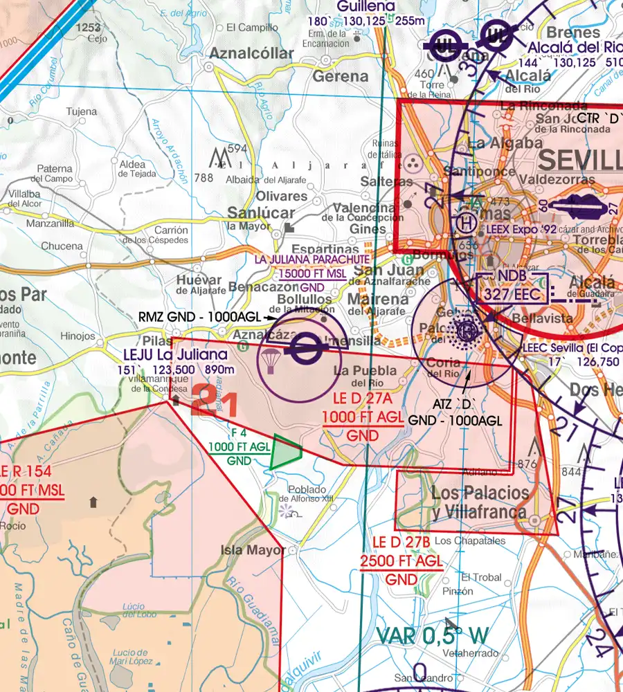
Rogers Data VFR aeronautical– ICAO charts have a very detailed representation of ATS airspace structures. They use a high-quality topographic map with shading and relief. This creates a dynamic 3D impression.
The charts include TMZ transponder mandatory zones, RMZ radio mandatory zones, airports, aerodromes and heliports with additional information, compulsory reporting points, reporting points on request, significant points (border crossing), Radio Navigation Aids with name, frequency and morse code.
Danger-, restricted- and prohibited areas, obstacles or group of obstacles and aerial sporting and recreational activities and areas with sensitive fauna. Furthermore, high-voltage powerlines are shown to increase situational awareness and flight safety in low-level operations. An isogonic line model with magnetic variation is included to support accurate navigation and heading corrections.
All Rogers Data VFR aeronautical charts are based on the latest aeronautical information from AIP and their supplements of CAA. They are based on the relevant regulations of ICAO Annex 4 and EU-Regulations.
Rogers Data Spain & Portugal VFR ICAO Aeronautical Chart
Current edition. Updated during the validity of the subscription.
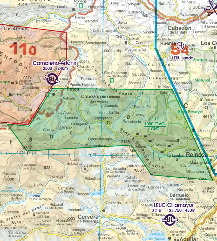
Special features for this region:
- TRAs temporary reserved airspaces
- ATZs aerodrome traffic zones
- Windmills, Wind turbine
- Visual flight routes
- Significant points (border crossing)
All Rogers Data VFR charts are designed to the following criteria:
- Spain & Portugal aeronautical chart on a scale of 1:500.000
- According to ICAO Annex 4; EU Commission Regulation; AIP
- Clear representation of the ATS airspace structure
- Detailed highly sophisticated terrain map with shading and relief
- Airports, aerodromes and heliports with additional information
- Radio Navigation Aids with name, frequency and morse code
- Compulsory reporting points, reporting points on request, significant points (border crossing)
- Danger- and restricted areas
- Obstacles or group of obstacles
- Minimum Grid Area Altitude
- Isogonic line model with magnetic variation
Additional information
| Delivery Methode | Download from website to EFIS USB stick, Dropbox data delivery, Download within EasyVFR 4 app, Export from EasyVFR 4 app to EFIS USB stick |
|---|---|
| Compatibility | Advanced Flight Systems AFS-5/6XXX series, Dynon Certified, EasyVFR 4, Dynon SkyView Classic and HDX |
| Country and Region Coverage | Portugal, Spain |
| Necessary Plan | EasyVFR Essential, Dynon Data only, EasyVFR Live, EasyVFR Pro, Frequent Flyer Membership |
Related products
-

Skyguide Swiss VFR Plates
Skyguide€49,99 inc. VAT / year Subscribe
VFR Plates -

DFS Poland V500 2024 (08AUG2024)
DFS€59,95 inc. VAT Add to cart
Charts -

DFS Germany VFR Plates
DFS€59,99 inc. VAT / year Subscribe
VFR Plates -

Dropbox add-on for Dynon SkyView
Dynon add-on€39,00 inc. VAT / year Subscribe -

DFS Croatia V500 2023 (13JUL2023)
DFS€34,95 inc. VAT Add to cart
Charts
