
Hello fellow aviator,
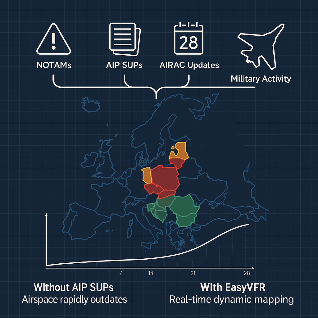
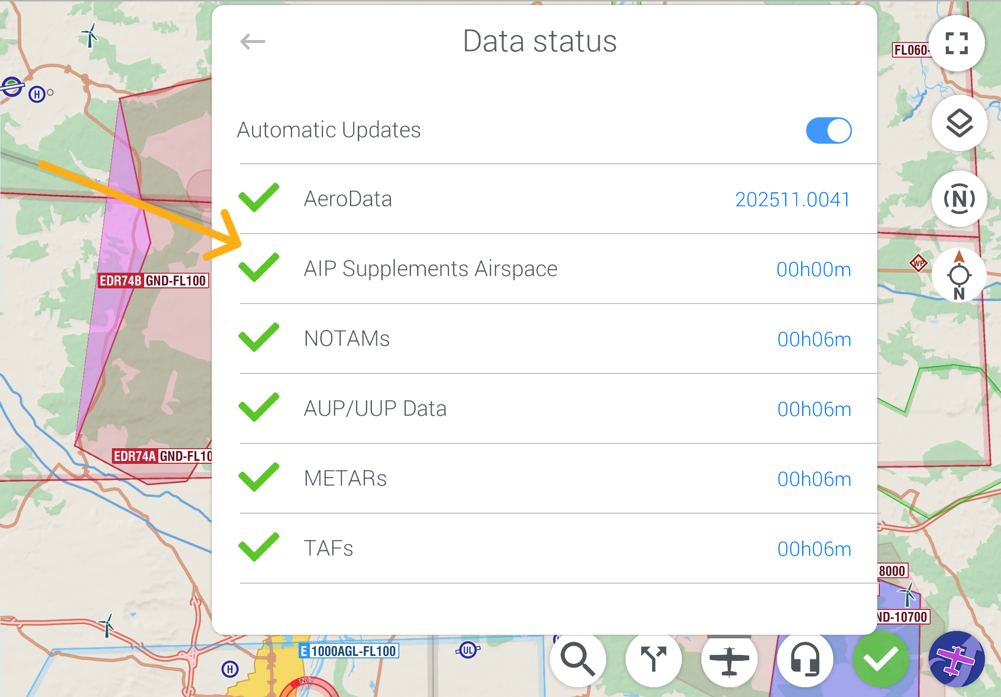
Our AeroData team tracks AIP Supplements in 42 European countries. In 2025 alone, AIP Supplements caused 1,861 airspace changes. Those temporary areas have always been on your EasyVFR 4 map.
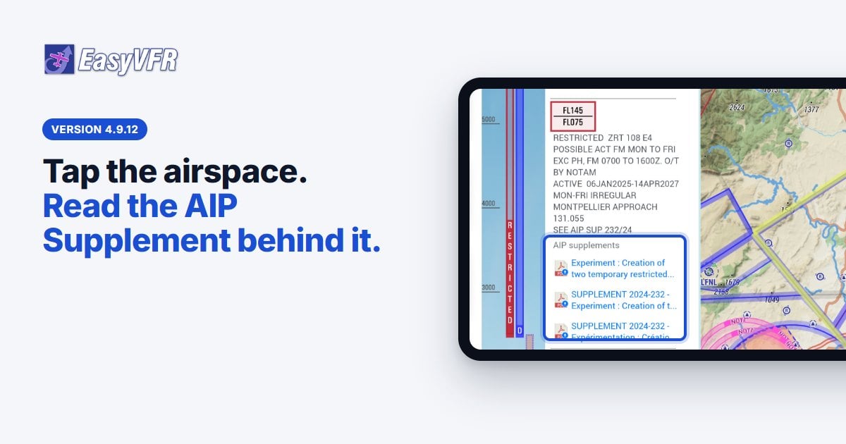
With EasyVFR 4.9.12 you go one step further: you open the AIP Supplement document that created the airspace, directly from the infocard. You don't have to search the website of the national AIS. You don't have to guess which supplement a NOTAM refers to. It works for every EasyVFR 4 user.
How it works
- Tap the airspace on the map.
- In the infocard, open the Airspace tab or the NOTAM tab.
- Under AIP supplements, tap the PDF.
The original document opens inside EasyVFR 4. Tap Back to EasyVFR 4 to return to your map, or Share… to send the document on.
It works from NOTAMs too. When a NOTAM creates or activates a temporary airspace, the NOTAM card now links to the AIP Supplement document and to the airspace itself. You see where it is, not only what the text says.
Three temporary areas on your map today
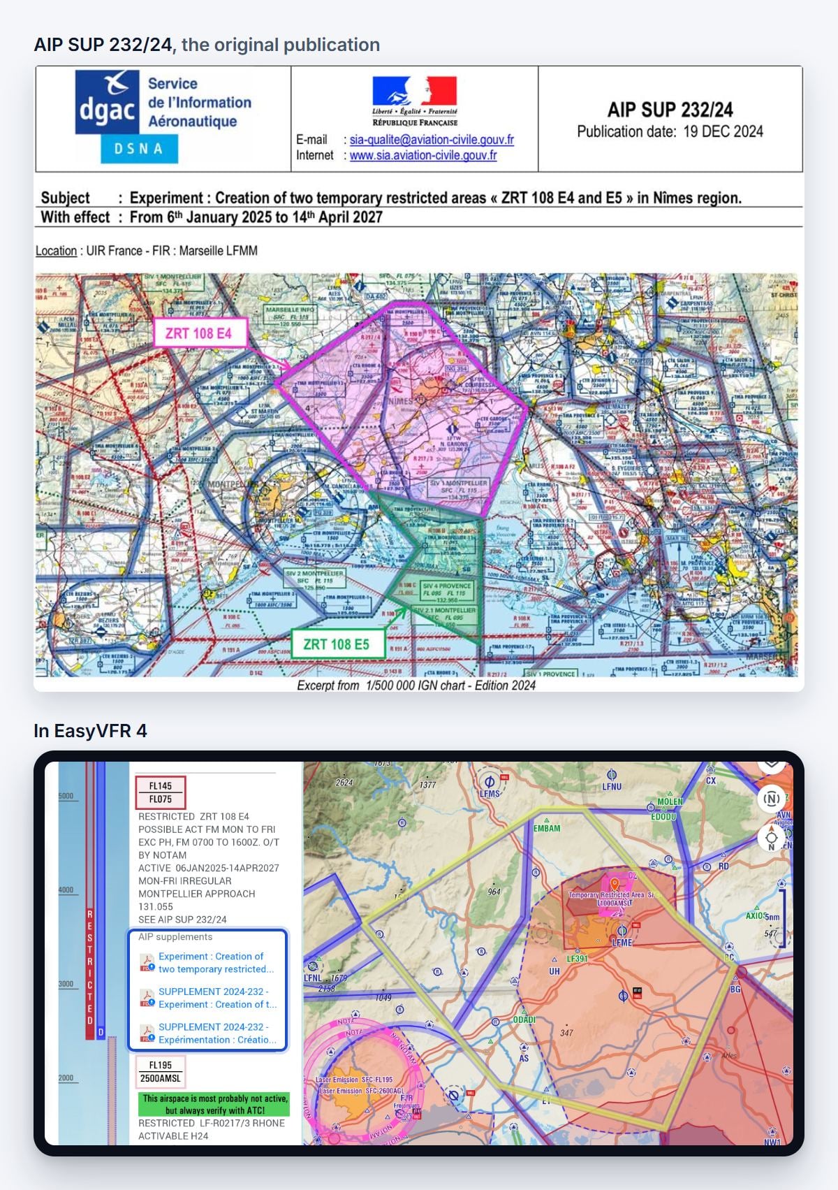
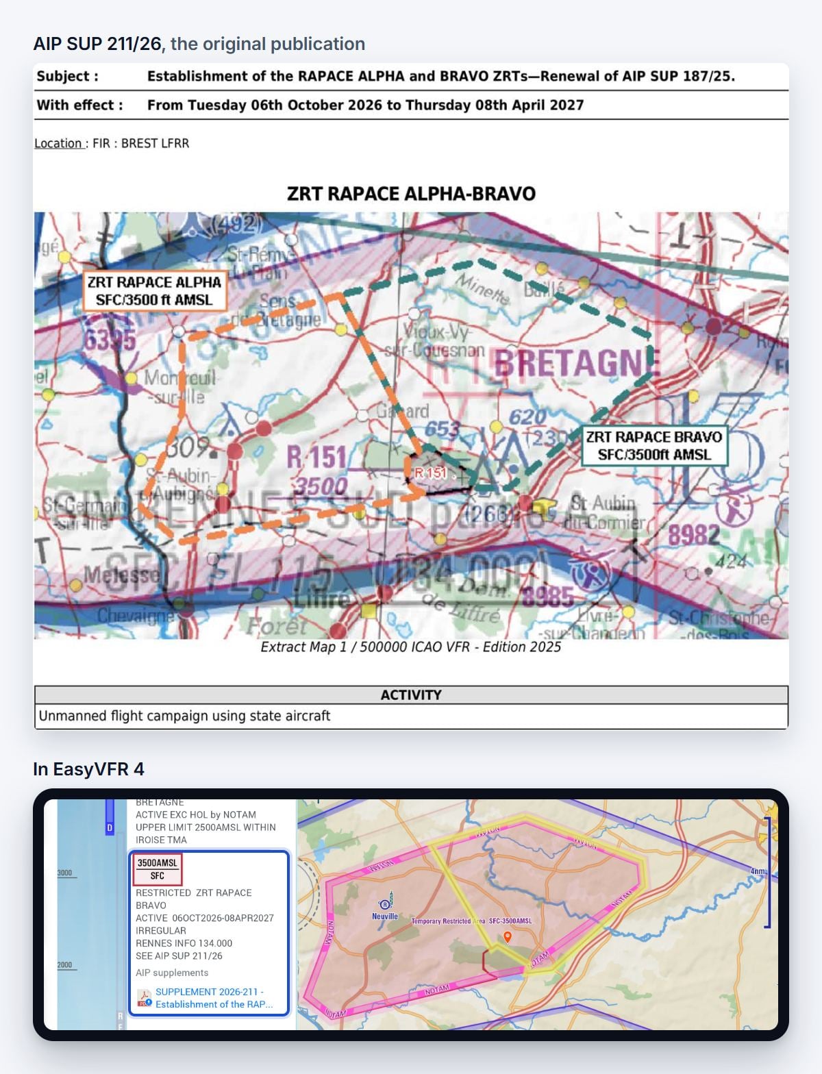
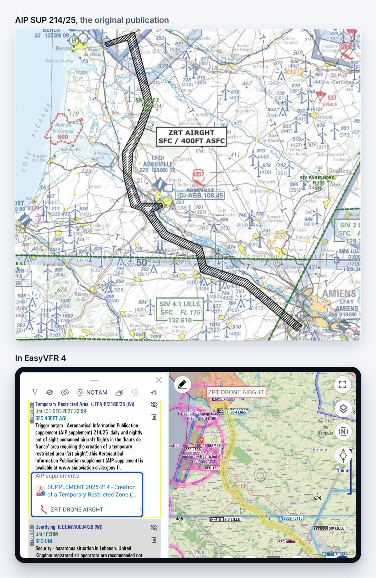
All three come from French AIP Supplements. Each picture shows the original publication on top, and the same area in EasyVFR 4 below it.
1. ZRT 108 E4 near Nîmes
An experimental restricted area, FL075 to FL145. AIP SUP 232/24, from 6 January 2025 to 14 April 2027.
The infocard gives you the essentials: possible activation Monday to Friday 0700 to 1600Z, Montpellier Approach on 131.055. One tap opens the full supplement, in English and in French. The same supplement also creates ZRT 108 E5, south of it.
2. ZRT RAPACE ALPHA and BRAVO near Rennes
Unmanned state aircraft, SFC to 3,500 ft. AIP SUP 211/26, a renewal of AIP SUP 187/25, from 6 October 2026 to 8 April 2027.
In EasyVFR 4, ZRT RAPACE BRAVO is “active irregularly”, Rennes Info on 134.000. That tells you to look closer: the full activation rules are in the supplement. The infocard links to the current supplement, SUP 211/26, not to the one it renews.
3. ZRT AIRGHT in the Hauts-de-France
A drone corridor from Berck to Amiens, SFC to 400 ft AGL. Its chart is in AIP SUP 214/25.
NOTAM LFFA/R/3166/25 only says that a temporary restricted area exists for day and night drone flights beyond visual line of sight. It doesn't show the shape. EasyVFR 4 puts the trigger NOTAM, the supplement and the corridor on one card, and draws the corridor on the map. It runs right past Abbeville (LFOI). Tap ZRT DRONE AIRGHT on the NOTAM card to jump to the airspace.
Why read the source?
The infocard is a summary. The AIP Supplement is the legally binding publication. It holds the details that don't fit on a map: how and when the area is activated, who to contact, and what is expected of you.
Before a flight near a temporary area, read the supplement. With 4.9.12 it is one tap away.
Also new in 4.9.12
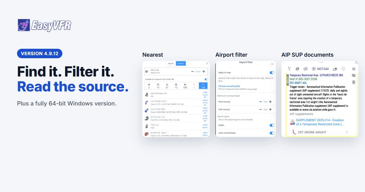
- A new Nearest window: airfields, airspaces and reporting points around you, sorted by your track
- A new Search with category tabs and recent searches
- An airport filter for runway length, airport type, fuel and services
- EasyVFR 4 for Windows is now fully 64-bit
Read about all of it, with the full list of improvements and fixes, in the 4.9.12 release post.
Get EasyVFR 4.9.12: App Store, Google Play or Windows.
Questions or feedback? Tell us in the EasyVFR 4 community forum, or write to [email protected].
Fly safe, fly current,
The EasyVFR Team




0 Comments