
Plan(e) Station mode for built in EaysVFR devices: Auto Start on Master Switch ON and more
Hello Fellow Aviator!
Hello fellow aviator! 👋
While many of you have been enjoying some well‑deserved flying and family time, we’ve been busy in the hangar. Version 4.6 focuses on speed, cockpit integration, and hands‑off convenience—so planning and flying feel smoother than ever.
Highlights at a glance
- Faster, more responsive UI and map interactions
- GPS sharing & AutoPilot steering via NMEA
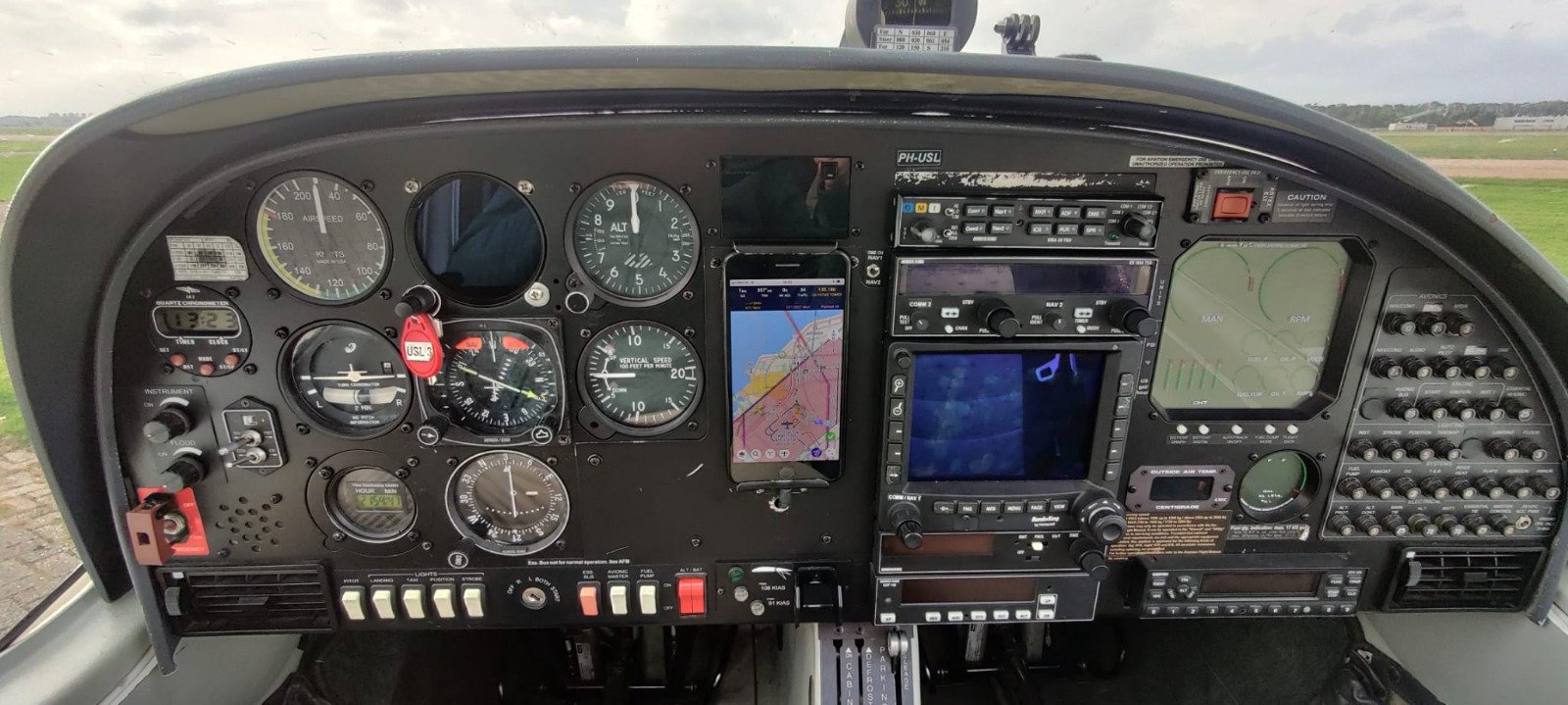
- Plan(e)station mode for fixed cockpit tablets and shared devices
- Clearer terrain & Vertical Profile behavior; smarter Radio, NOTAM and Weather displays
- Rogers Data ICAO charts integrated across the EasyVFR ecosystem
A big thank‑you to our beta community for your feedback — you help us build better tools for all GA pilots. 🙏
Blue skies and safe flying,
— The EasyVFR Team ✈️
On this page:
Rogers Data charts now available
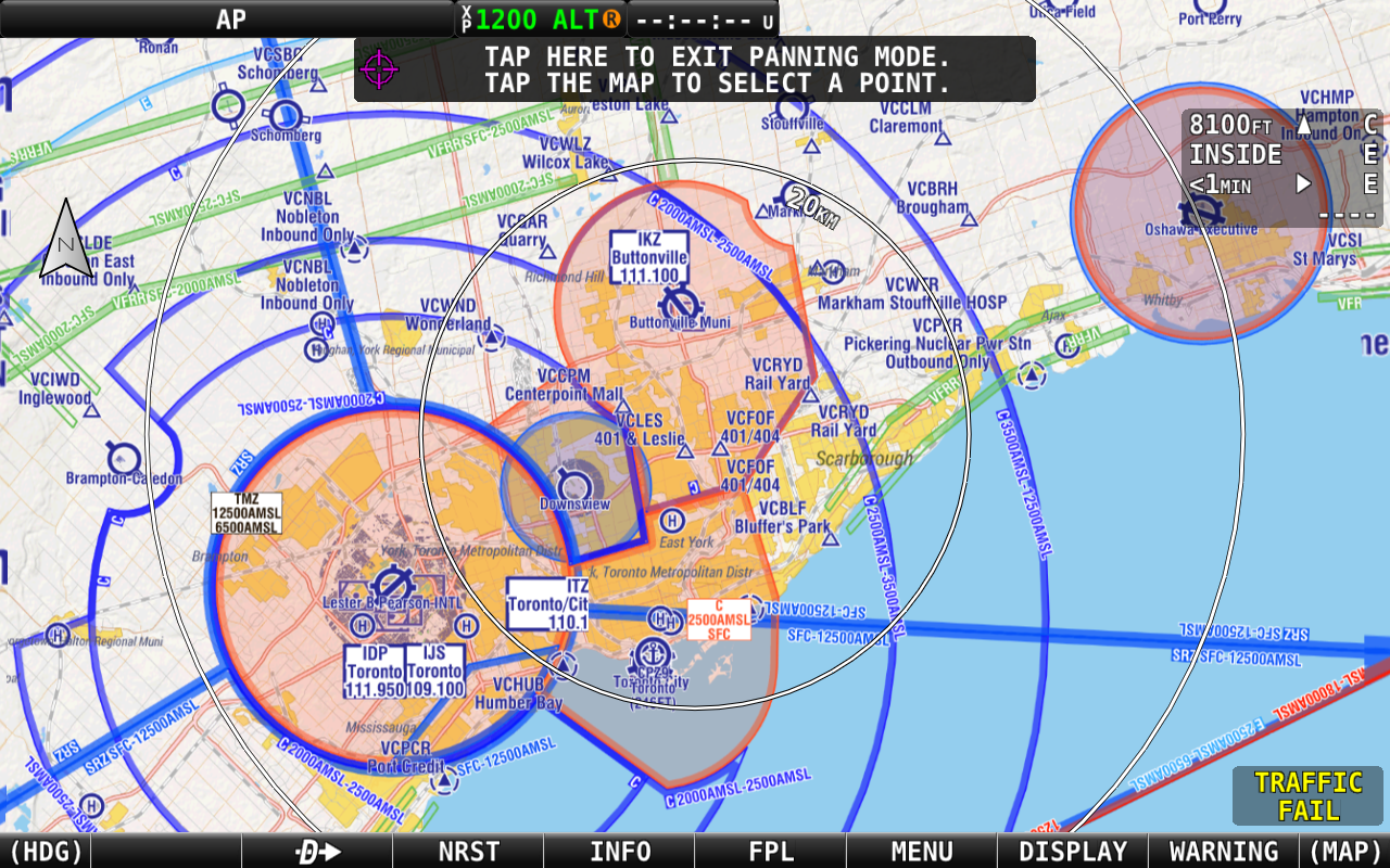
This summer we partnered with Rogers Data! 🌍 Rogers Data VFR ICAO charts are now fully integrated with EasyVFR across Android, iOS, Windows and macOS — and available on Dynon SkyView/AFS via our distribution system.
What you get
- Combine Rogers Data with EasyVFR AeroData for interactive VFR navigation
- Full Europe bundle or regional packs (Germany, UK & Ireland, Scandinavia, Spain & Portugal, etc.)
- Detailed ATS structures, navaids, obstacles, danger/sensitive areas and airport data
Learn more and get Rogers Data: Rogers Data VFR ICAO Charts

Responsiveness
We’ve focused on UI and map responsiveness across platforms and many devices:
- Faster reactions when tapping buttons and opening info cards
- Smoother map interactions and info lookups
This is ongoing — your feedback helps us keep tuning
GPS sharing & AutoPilot steering (NMEA)
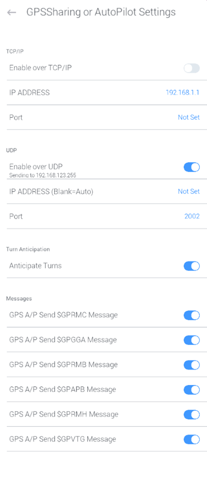
If your autopilot accepts NMEA, EasyVFR 4 can now transmit standard NMEA sentences from your device’s GPS or an external source over Wi-Fi.
- Supported NMEA sentences:
$GPRMC,$GPGGA,$GPRMB,$GPAPB,$GPRMH,$GPVTG - Connections: TCP or UDP over Wi‑Fi / Ethernet (works well with Wi‑Fi→RS232 adapters)
Where to configure: EasyVFR 4 menu → System → GPS Sharing / AutoPilot Settings
Step‑by‑step guide: Autopilot and GPS-Sharing
Plan(e)station mode — fixed cockpit tablets & shared devices
Note: This is only intended for power users comfortable with a simple configuration file.
Plan and Plane station mode lets you configure a public/shared device with a single XML file. Lock key settings, keep data fresh, and hand over a consistent setup to the next pilot.
Typical use‑cases:
- Club/Rental plane: Permanently installed tablet stays consistent for every pilot, resets to a clean setup, and keeps the screen on when the master is ON.
- Briefing room: Ground‑only kiosks in dispatch or club rooms—secure, simple, always ready for planning.
Setup guide & sample XML: Plan(e) Station Mode - Setup EasyVFR for Public Use
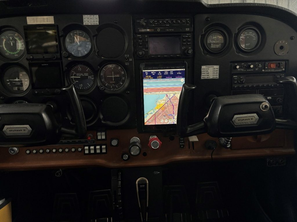
We would love to see what you do with it. Feel free to send us an email with your use case and images.
Terrain and Vertical Profile (VP) Consistency
Terrain awareness is now more consistent between planning and flying thanks to two configurable terrain widths:
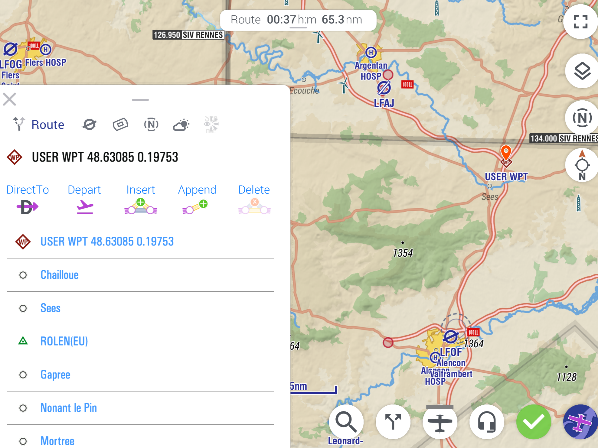
- NarrowPath (default 1 NM): used for VP narrow route, route planning, and AGL readouts
- WidePath (default 10 NM): used for MSA calculations and the VP wide route
Configure via: Map Layers → Terrain
This helps you see the right terrain context for the job—planning vs safeguarding.
Nearest place and METAR circles
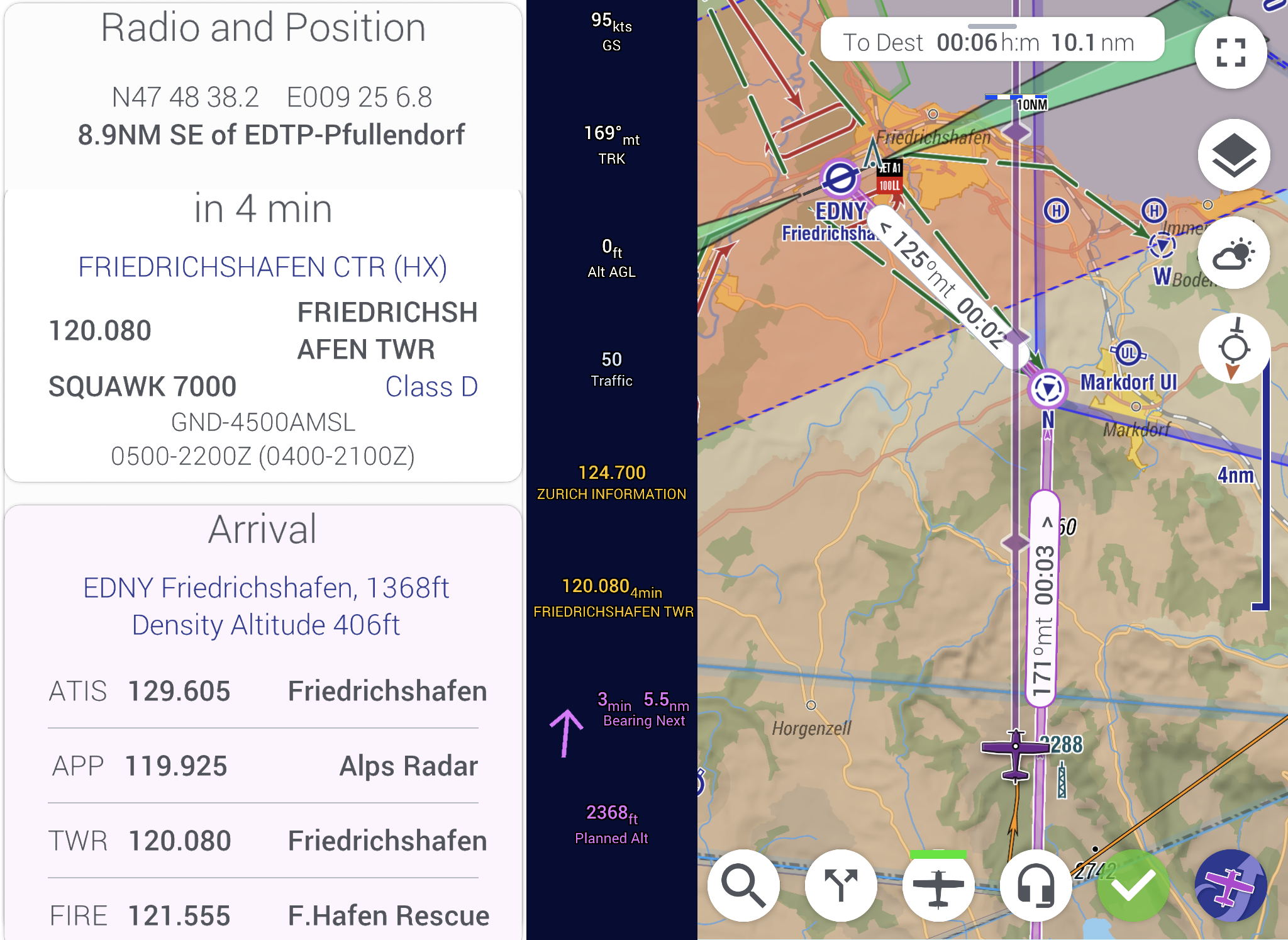
Radio & position card
- Position now includes “relative to nearest town,” useful for ATC
- Clearer hints for the current and next airspace on the Radio and Position Card (🎧), including frequency and squawk
- Improved logic when two airspaces are equally relevant
Weather
- Bigger, clearer METAR circle depictions aroudn aifields, visible at higher zoom‑out levels for quick regional overview (providing a GAFOR like overview anywhere)
- VP weather lines and references render more consistently for local flights

Graphical NOTAMs improvements
- Better plotting for complex NOTAM shapes (including metadata polygons)
- Tap any NOTAM label to open the full Info Sheet
- Long NOTAM text displays more reliably in planning tabs
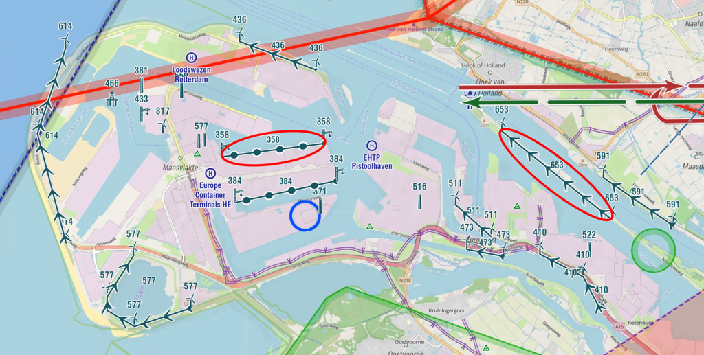
Row of multiple similar obstacles
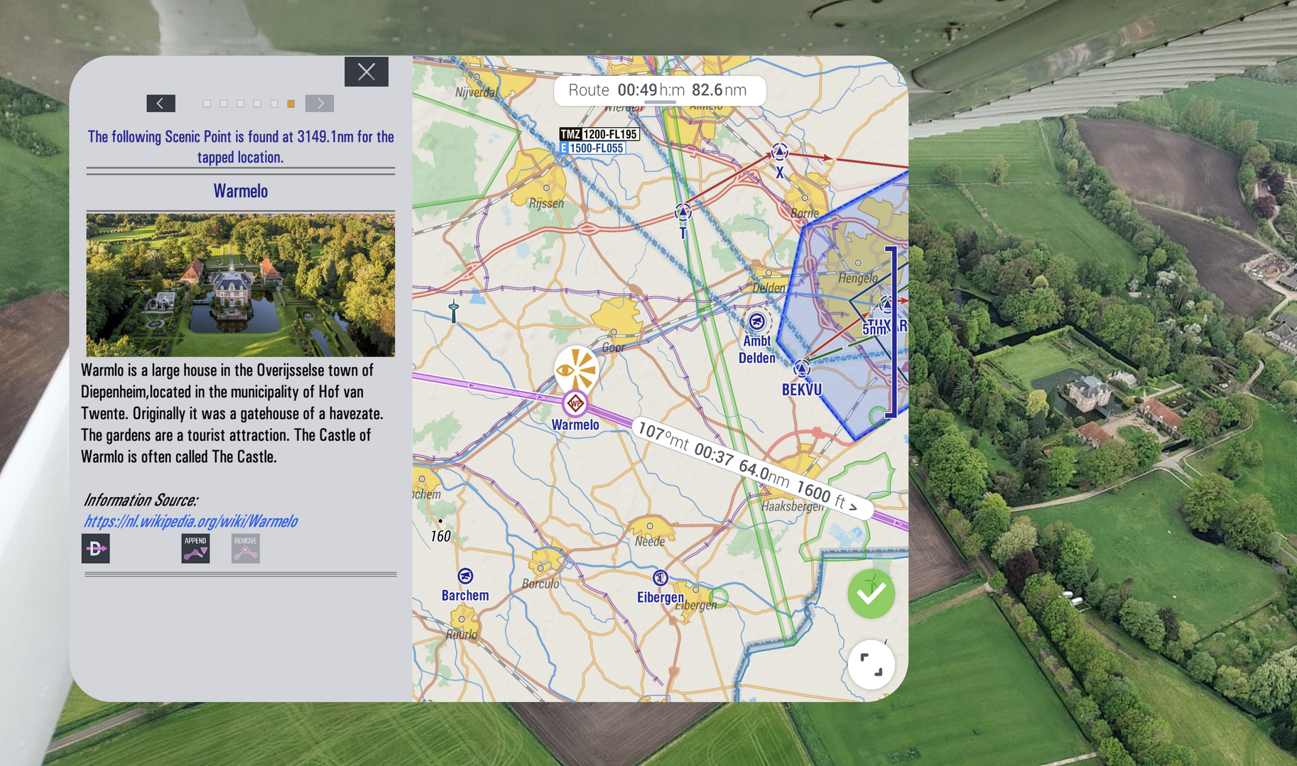
Our obstacle feed can include line shapes representing a sequence of obstacles (e.g., rows of wind turbines, crane lines). This is especially useful when the area and alignment of the hazard matter more than each individual point — Rotterdam harbour crane rows and wind‑farm strings are good examples. The Netherlands is the first region to provide these via Eurocontrol; other countries will be added as they adopt the format.
More enhancements & fixes
- First-time install: choose vector or raster basemap and enjoy faster initial downloads
- Settings backup: app settings are automatically stored to cloud for reinstall same or other devies
- Airspace highlighting: more predictable behavior (tap again to unhighlight; closing info card clears highlight)
- VP and VP weather: reliability fixes and clearer altitude references
- Route editing: “Automatically Confirm Route Changes” clarified and stabilized
- Raster basemaps: improved markers and zoom behavior
- Multiple stability and crash fixes across workflows
There’s even more under the hood—too much to list here! See the release notes for all the details.
Behind the Scenes - What's next?
While 4.6 brings plenty you can see and feel, our most significant work is happening under the hood. We’re upgrading data pipelines and core OS integrations to deliver faster updates and smoother cockpit connectivity.
Here’s what we can share today:
- 📡 Bluetooth Low Energy (BLE) cockpit connectivity:
BLE support is finalised for Android and iOS in the next release. Anything EasyVFR 4 can send over Wi‑Fi can now also be sent over Bluetooth LE — opening the door to many more cockpit integrations. We’re already integrating selected hardware. Which BLE devices should we prioritise? Tell us. - 🔃 Faster AIP Supplement updates:
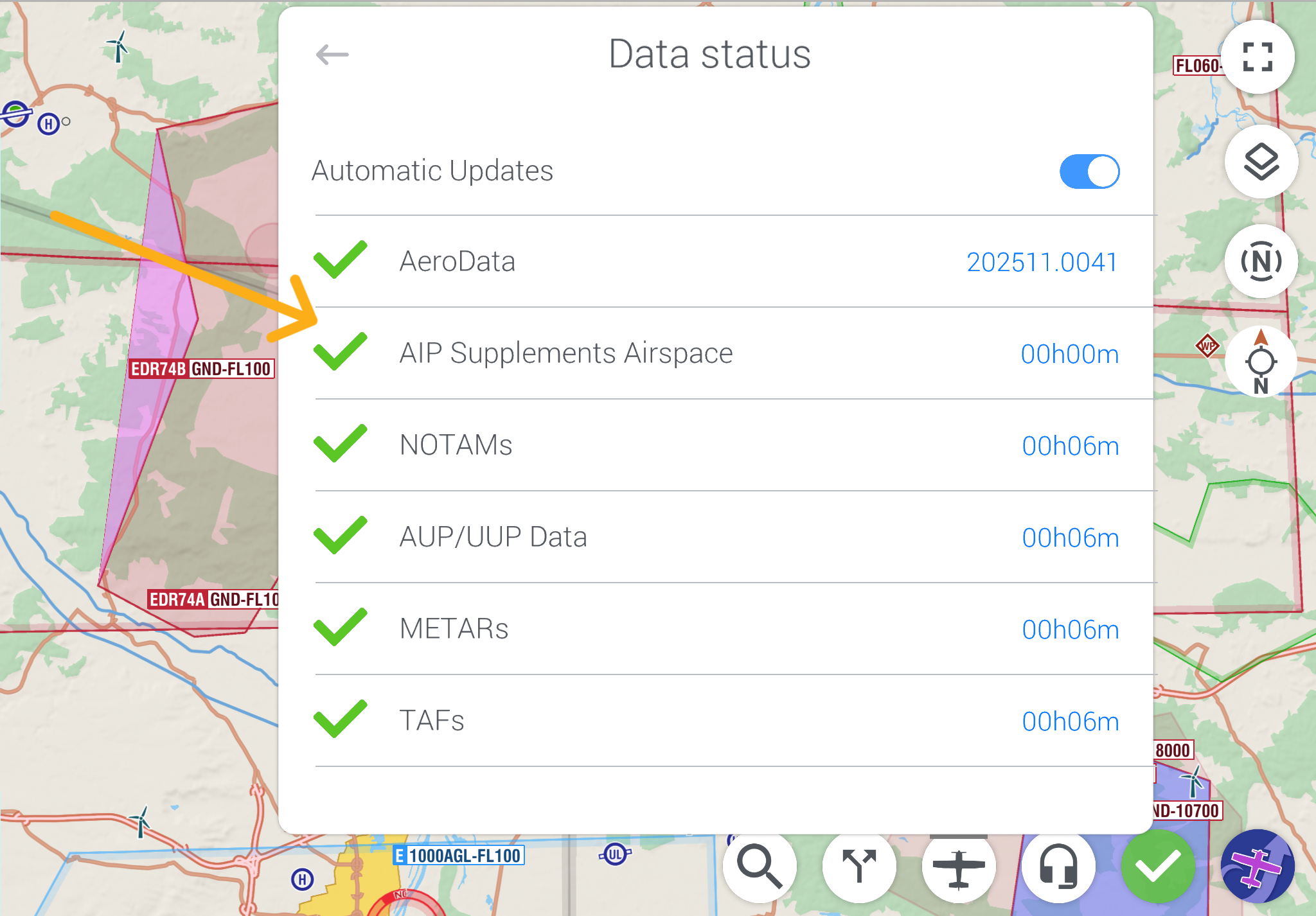
EasyVFR already includes AIP Supplements in AeroData and falls back to our internal NOTAMs feed for last‑minute SUPs. We’re simplifying the UI and data model so Supplements can be refreshed more often — moving toward near‑daily updates to deliver last‑minute changes faster. - ⚡ Next‑gen NOTAMs & Dynamic Airspace Mapping:
One more thing...🙃
Over the past two years we’ve completely re‑imagined NOTAM ingestion: how our servers receive and normalise messages, how data is distributed, and how apps consume dynamic airspace information. V1 of the new backend and API is complete and is being rolled into EasyVFR 4 and into an entirely new product. Our goal is simple: remove the confusion around NOTAMs and temporary restrictions so you get clear, effortless, complete and actionable airspace information for your VFR flights — in the EasyVFR app, via a new tool, and through partner integrations.
We expect to invite all EasyVFR Live, Pro and FFM users to early access before year‑end. What would you like this tool to be?
We’re building the future of EasyVFR — and this is just the beginning.
Tell us and stay tuned
How to Update?
Updating to EasyVFR 4.6 is easy—just follow the link for your platform:
- iOS → Head to the iOS AppStore.
- Android → Find us on Google Play store.
- macOS (Apple Silicon) → Look under iOS apps in the AppStore.
- Windows, macOS (Intel/Catalina) → Visit our knowledge base for the latest downloads.
New to EasyVFR?
Start your journey with EasyVFR 4 today!
📱 Download the app using the links above ☝️
🧾 Create your free account directly in the app
Try it out and let us know what you think. We’ve got even more exciting features on the way—so stay tuned!



0 Comments